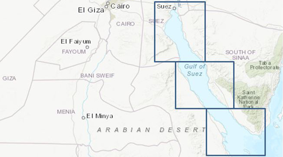
CHARTING THE GoS
As ⅓ of the global maritime trade passes through the Suez Canal every year causing high traffic in the Gulf of Suez and several offshore platforms, has only come with responsibility upon our office as safety of navigation is our number one priority. Surveying the whole Gulf of Suez in 100% full sea floor coverage, a challenging mission to identify the safety hazards for navigation and to understand our marine environment more.
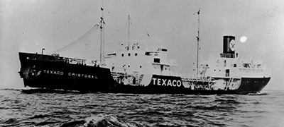
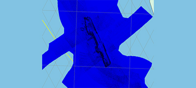
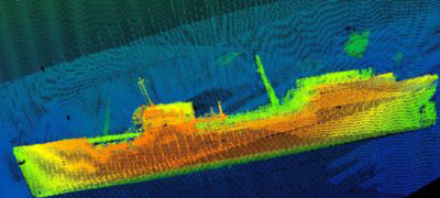
TEXACO CARISTOBAL CARGO SHIP sunked on 24/02/1967

Accuratly identified by our highly-experienced team during this project north west Moragan-1 complex oil field
Cleaned, and
Processed
Three Coastal charts (GOS01, GOS02 and GOS03) along with 1 larger scale chart (GOS2G) and a harbour band chart (Ras Shukeir Marine Port) covering the entire Gulf of Suez will be produced and distributed in mid-2020 with reliable, consistent and updated data to satisfy the international Mariners transiting the Gulf of Suez.
In this way only we can confidently secure our national investments and maintain our safety of navigation.